


ITINERARI A CAVALLO
Il periplo del Còmero
Il periplo del Còmero
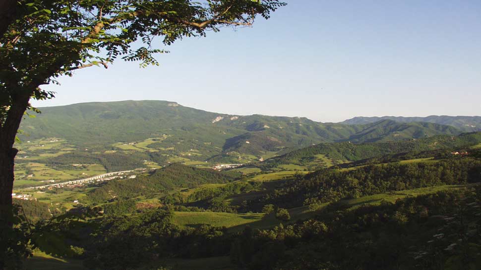
We propose a long excursion around Mount Còmero: domestic mountain, between the towns of Bagno di Romagna and Verghereto, whose imposing size connects the territory of the high Valle del Savio and is a constant reference point. It is a journey around its slopes full of woods and waters, environments, colors and smells that change at any time and season, along paths that invite you to climb into a gentle and serene landscape, which contrasts with the sharp and rugged ridges of this part of the Apennines where the Romagna passes through Tuscany.
The departure is scheduled by Fattoria Ca 'di Gianni, just above S. Piero in Bagno. From its large stables we take us on the road that in short, flowing between fields, leads us to the junction with the SP. 43; reach it, we walk a few hundred meters and then take the detour to the right to Lake Pontini: immediately after, turning left, take the trail that goes up to Valbonella, a tourist center also equipped with paddocks. From this balcony overlooking the upper Valle del Savio, follow the dirt road that crosses "The garden of aromas" and takes to the area of "bandits": after about 700 meters, at a crossroads, we proceed to the left dirt road - marked b / r from the "Val di Bagno Trek" - which, touching an outlet of the municipal aqueduct, takes us to Acquapartita: emerging on a dirt road we face the lake. We follow to the right on this private white road going towards the "Lake of S. Francesco", and after about 2 km between pine and beech woods we pass a gate on the left and continue towards Cippo dell'Alpino, an enchanting place, equipped with water and tables, on the half-coast of Pian delle Corsicchie that slopes towards Alfero, and from where a wonderful panorama opens up over most of Romagna. After a compulsory stop, we go back for 100 meters and we take on the right, from where with a white road we reach the houses called il Pozzo. We still have the right and always taking the dirt road, between pastures and beech woods we reach the Pass between Monte Testaccio and Monte Comero, where in a wide open space more roads cross: we follow right and at the first gate we turn left and then exit at Spinello; then left again to find the b / r signs that lead us to S. Catale, a block of houses among centuries-old chestnut trees, where a dirt road takes us up to Lago dei Pontini. We take us to the junction where the municipal comes so far from the SP. 43 and turn left and then right onto a track that passes in front of the house called Bramalpane and descends to the farm La Banditina: in 1 km you are back to Ca 'di Gianni.
ROUTE: Ca 'di Gianni (606 meters above sea level) - Valbonella (718) - La Presa (760) - Lago di Acquapartita (752) - Cippo dell'Alpino (990) - Pozzo (1.046) - San Catale (856) - Lago Pontini (748) - Bramalpane (744) - Ca 'di Gianni (606).
Length: 30 km / Gates: Pozzo / Acqua area: Ca 'di Gianni, Valbonella, Pozzo / Few flies / Car parks and stables: Ca' di Gianni. To be carried out in every season.


 Facebook
 Instagram
 Youtube