


TREKKING, ESCURSIONISMO, SCIALPINISMO
The Wolf ring trail
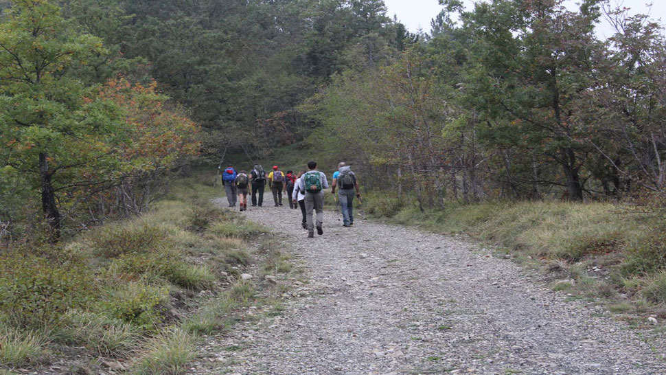
The Wolf ring trail
Just outside the residential area of Bagno di Romagna (494 asl) toward the south and at the side of the provincial road SP. 138, a stone on the right marks the beginning of the "Mulattiera di Pietrapazza" (Pietrapazza Mule Track) which leads to far off Ridracoli. We take it and continue to follow the blue/red signs of the CAI 189 trail and Val di Bagno Trek. The well paved road immediately passes by the Falcone farm and a little further on the "Cappella Fabbri della Faggiola”, a chapel dating from 1880. From this point we continue to wind our way through the valley cut deeply by the Volanello River, for a while overlooking the path to Fonte del Chiardovo below. We ignore the turnoffs and continue the pleasant climb alongside the Volanello River with its waterfalls and then pass by the ruins of the Barco, Casa Nuova and Prati farms, which were inhabited until a few decades ago. After passing the last of these and covering about 800 m we come to a fork and take the right branch to the "Sentiero del lupo" (Wolf’s trail.) (1005 asl). After about 100 m we come to a pleasant forestry service road (CAI 201) that passes just under the top of Monte Càrpano (1137 asl), opening up panoramic views of the top end of the Savio Valley with Monte Còmero dwarfing the landscape to the east and further off Monte Fumaiolo and the Alpe della Luna while the view to the south is closed by the main ridge of the Apennines between Romagna and Tuscany. We continue along the forest trail which now runs between the valleys of the Bidente di Pietrapazza River (left) and Incisa River (right) sloping down to the Savio River and dotted with farms. Passing through clearings we catch sight of Monte Castelluccio (1115 asl) which the trail skirts just below the top and then enters the "Macchia del cacio" (Cacio bushland). We leave the CAI 201 trail here when we reach the sign and turn right into the CAI 193 (1044 asl) which rises gently into a wood. We are right at the junction of a short secondary ridge which extends as far as Corzano and which breaks off from the long secondary ridge dividing the valleys of the Savio and Bidente-Ronco rivers. The narrow trail then begins to climb down through the very beautiful bushland of the Macchia del Cacio, after which a view of the Apennines opens up from the mountains of Mandrioli to Monte Fumaiolo, while on the right, at the bottom of the valley, the town of Bagno di Romagna can be seen. The trail, which has been deeply eroded by the rain, winds along the ridge through sparse vegetation, also offering a view of the small hills which slope down on the left toward S. Piero in Bagno. The trail then widens with paved stretches, often accompanied by dry stone walls. In the Middle Ages this was the road connecting the small fortification of Castelluccio and the castrum of Corzano. Finally, on a stretch once again narrow, we enter a wood and come out on the other side onto a little saddle (766 asl), known as Pian della Croce. Here we leave the CAI 193 trail, which continues on the left to the Castle and Sanctuary of Corzano – which deserve a visit and are only 1 km away – and continue on the right, past a chain and along an unmade road. The going is now pleasant on a wide track that passes through fields, woods of various tree types (Austrian pine, spruce, Arizona cypress...) on its way down through the Incisa valley, cut through by the Cappella River and overlooked by the high crest of the Ripa del Toro. All around there is countryside with herds out to pasture and inhabited farms (Campodonico, Montanino di sopra, La vigna, Casina...). In a small plateau, what remains of the old oratory of S. Maria Maddalena emerges from a clump of trees located near Batòcco, a farm which can be seen on the right. We are now at the first houses of Bagno di Romagna. The trail becomes an asphalt road and quickly winds its way through vegetable gardens down to the town.
Warning! Because of the bad weather of the last winter and spring season, along mule tracks and paths you can find trees and signs fallen on the ground, therefore we strongly advise and with care, where the tracing or conventional signs are no longer visible or not explanatory, to adopt the utmost caution and above all to interrupt the chosen ring by retracing the steps already taken backwards.
PATH: Bagno di Romagna - Valle del Barco - Sentiero del lupo - Bagno di Romagna. LENGTH: km 13,800 - TIME TRAVELLING: 4,30 hours. DETAIL: Bagno di Romagna - entrance Sentiero del lupo: km 4,400 / Sentiero del lupo - Macchia del Cacio: km 2,800 / Macchia del cacio - Pian della Croce: km 2,700 / Pian della Croce - Bagno di Romagna: km 3,900.


 Facebook
 Instagram
 Youtube