


ITINERARI SPIRITUALI
Mulattiera dei pellegrini di Passo Serra
Passo Serra Pilgrims' Mule Track
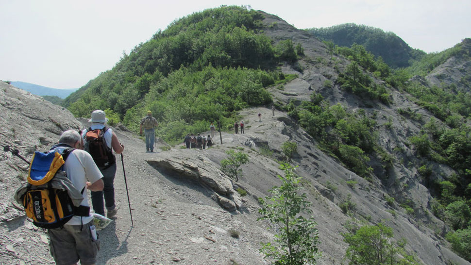
Ever since the Middle Ages there was a “pilgrims’ path” going through Bagno di Romagna and described in thirteenth century guides. It was followed by local pilgrims to cross the Apennines and reach Rome. Today, part of that religious route is a splendid mule track, full of fascination and landscapes: CAI footpath no. 177 and Val di Bagno Trek, marked and charted (km 5.00). It starts from the Gualchiere, south of Bagno di Romagna, to the side of main road SS 137 which leads to Verghereto. After the reclaimed section, you walk through a narrow valley, marked by the gorges of the Gualchiere ditch. The paved mule track reaches the point where the Fosso del Chiuso flows into the Fosso del Capanno over which there is a stone bridge. Immediately after that, near Maestà Balassini, you begin to climb steep slopes along the crag towards the Nasseto Plateau. The landscape opens up: you walk on the edge of the wilderness area Fosso del Capanno, between the side we are climbing and the winding main road SS71 towards Passo dei Mandrioli. You then get to the wide Nasseto plateau, with the remains of the farm by the same name. A beautiful maple and turkey oak avenue indicates the old route which continues downhill along a slippery and friable clay formation, then delves into the thick beech woods covering the slopes of Mount Zuccherodante. Finally, after many hairpin bends, you reach Passo Serra (1150 a.s.l.). A milestone was put up in 1998 to indicate this ancient route. On the other side of the ridge there is route 00. In front of you there is the Casentino area: continuing to the left you get to Santuario della Verna; if you turn right, on the other hand, you can reach Passo dei Mandrioli and the Camaldoli hermitage.
FOOTPATH CAI 177 and "VAL DI BAGNO TREK": fully marked w/r - LENGTH: 5.00 km from Gualchiere - SLOPE: + 635 - DURATION: 2.30 / 3 hours - DIFFICULTY: medium – WATER POINTS: Gualchiere. ROUTE DETAILS: Gualchiere (515 a.s.l.) - Maestà Balassini (530 a.s.l.) - turning: to the right towards CAI 177 footpath - Nasseto (899 a.s.l.) - Passo Serra (1150 a.s.l.).
After Bagno di Romagna, head south along SP 138 then SP 137, for about 1 km, until you get to a roadside clearing; to the right you have the beginning of the route. It is not advisable to set off on this excursion if it rains and in wintertime. Be careful when walking along the clay stretch shortly after the Nasseto plateau. Strong walking shoes, rug and flask are recommended.


 Facebook
 Instagram
 Youtube