


TREKKING, ESCURSIONISMO, SCIALPINISMO
The San Piero ring trail
The San Piero ring trail
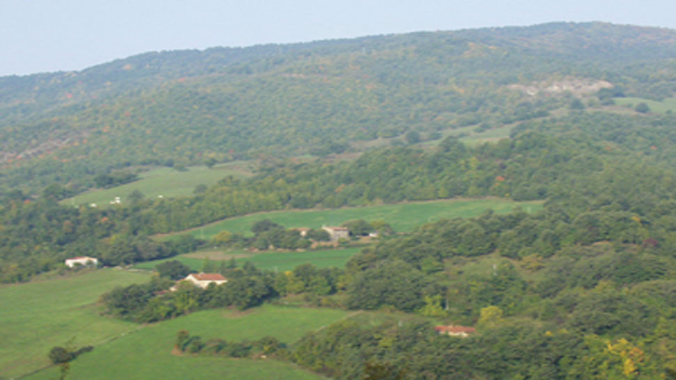
Alongside the parish church of San Piero in Bagno (466 asl) we find the first blue/red signs of the CAI 193 trail and the "Cammino di San Vicinio" (Way of San Vicinio) which climbs toward the Sanctuary of Corzano. About one hundred metres further up we take the mule track on the left, restored by the "Il Faro di Corzano" association, and up we go. It is punctuated by bronze stations of the Via Crucis by the artist Carmelo Puzzolo. After 1 km we arrive at the asymmetrical church of the Sanctuary, built in the middle of the eighteen hundreds to conserve the fresco of the “Madonna with Child” in a small church amid the ruins of a castle. All that remains of the castle are some impressive sections of the walls on a spur just beyond the tree covered plateau that we are crossing. The Sanctuary and the walls are worth a visit. The trail now slopes down toward the car parks. From the top car park we follow a wide track marked with the blue/red signs of the CAI 193, which passes by the “il Monte” house (710 asl) and runs along a small ridge between the Savio valley and the smaller Paganico valley with its patchwork of fields. At Pian della Croce (766 asl), a small pass in the form of a saddle between valleys, we come to a fork. A wide track signposted CAI 193b descends to Bagno di Romagna whereas our 193 trail is on the right and drops rapidly into the wood after which it levels out to a gentle slope in a beechwood. We ignore the turnoff on the left of the "Cammino di San Vicinio" and follow our trail which starts to climb. This stretch, which is very beautiful, retraces a medieval route between the castrum of Corzano and a fortification of which the place name remains (Castelluccio). On the narrow eroded path on the secondary ridge there are traces of paving and low walls. The sparse vegetation opens up the view over the little Paganico valley on the right, the Incisa valley on the left with Bagno di Romagna at the bottom. Looking upward offers a view of the Apennine range crossed by the Mandrioli Pass and the Via Romea (pilgrims’ way to Rome) of the Serra Pass. The trail then enters the beautiful bushland of the Macchia del Cacio where it is embedded deeply in the ground. On arriving at the top (1045 asl) we soon start to descend and come to a wide track along the ridge (1001 asl), signposted CAI 201, which we take on the right. In about 700 m we reach the Monte Piano Pass (992 asl) joined on the right by the municipal road of Paganico that goes from San Piero to Rio Salso (left). We cross it still following the CAI 201 which climbs through a dense beechwood toward Monte Piano (1062 asl). Just before the summit we come to the CAI 123 and VBT7 trail which goes down to Rio Salso on the left and which we ignore. As soon as we start to descend we leave the CAI 201 which goes on to Monte Frullo and take the VBT7 trail on the right toward S. Piero in Bagno, marked by signs and a cross (1055 asl), which follows the mule track that once went from San Piero to Rio Salso and Ridracoli. After passing a dilapidated gate the trail drops steeply through a wood which has recently been cut until it emerges into a spacious clearing. Immediately on the left an old memorial stone indicates "Mulattiera di Ridracoli" (Ridracoli Mule Track), fragments of which can be seen here and there. Below us a view opens up of Valmaggio with its scattered - now derelict - farms and further off we can see the middle section of the Bidente Valley. Looking right our gaze falls on the town of S. Piero toward which the trail descends. Passing though pastures we cover what remains of the mule track until we turn left into the municipal road of Paganico (775 asl) a few dozen metres below the Vètrice farm. While the trail descends pleasantly through cultivated inhabited land we can enjoy a view of Monte Còmero which closes the horizon. After about half a kilometre we pass the right fork leading to the hamlet of Paganico. One km further on, at the “Raggio di sopra” farm, a votive shrine to the Madonna can be seen on the left. This was built in 1907 and bears two references to the old road system: km 0 of the Paganico mule track which started on the left and km 1.490 which was the distance covered so far from S. Piero on the Ridracoli Mule Track. We still have a couple of km of downhill before reaching the Villanova bridge and the town of S. Piero in Bagno.
Warning! Because of the bad weather of the last winter and spring season, along mule tracks and paths you can find trees and signs fallen on the ground, therefore we strongly advise and with care, where the tracing or conventional signs are no longer visible or not explanatory, to adopt the utmost caution and above all to interrupt the chosen ring by retracing the steps already taken backwards.
PATH: S. Piero in Bagno - Corzano - Macchia del Cacio - Monte Piano - S. Piero in Bagno. LENGTH: 9 km - TIME TRAVELLING: 3 hours - DETAIL: S. Piero - Corzano: km 1, 200 / Corzano - Pian della croce: 1 km / Pian della Croce - Macchia del cacio: km 2,10 / Macchia del cacio - Monte Piano: km 0,700 / Monte Piano - crossroad below Vetrice: km 0,600 / crossroad Vetrice - S.Piero: km. 3,300.


 Facebook
 Instagram
 Youtube