


TREKKING, ESCURSIONISMO, SCIALPINISMO
The wild orchid trail
The wild orchid trail
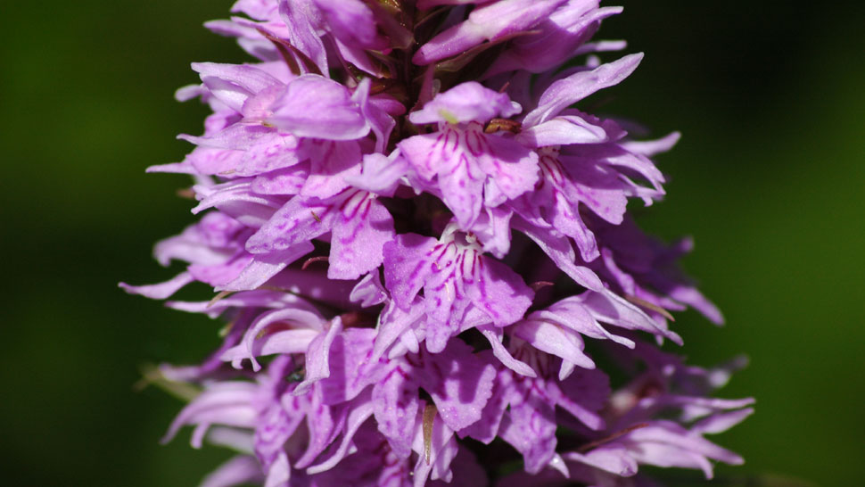
This trail is packed with picturesque scenes and panoramic views which are made even more beautiful in the late spring by various wild orchid species in blossom and– if you are lucky – encounters with roe deer in any season.
From the public gardens of Via Lungosavio (495 asl) we cross a pedestrian bridge over the river and take the "Sentiero degli Gnomi" (Gnomes’ Trail) and the CAI 167B. The trail immediately starts to climb into the wood following the course of the Armina River. We follow the blue/red signs ignoring the various turnoffs on the left and right. On reaching a fountain, the trail bends sharply left and then immediately right and continues to climb, marked by a picket fence, until it comes to a small clearing on the “Gnomes’ Trail” equipped with various attractions. We look for the blue/red signs on the trees. They are located next to the large head of a gnome and point the way to the equipped area of the fantastic world of gnomes. Here we must turn left toward two small wooden houses after which a beautiful view over Bagno di Romagna opens up. The trail disappears again into the wood and becomes very steep for a few dozen metres on the way up to the ruins of Pian Baserca, also known as Pian Basilica (628 asl), a house abandoned in 1970 which has the same name as the extensive plateau on which it stands. A wide unmade road circles the house and joins another unmade road arriving from the right, from the “Roccaccia”. Here we leave the 167B and follow the CAI 161 on the left which circles the house, passes a bar and continues through a large meadow. The trail immediately begins to climb toward Poggio Vìtine, a small hill at the top of which there is a television broadcasting station (838 asl). Before reaching the repeater station, where the unmade road ends, we turn off to the right and start to follow a path, still marked blue/red CAI 161, which passes through a little wood and then follows a ridge in a southerly direction offering panoramic views over the Larciano Valley and Còmero on the left while on the right there is a view of the southern part of Bagno di Romagna. At this point gentle slopes alternate with steep climbs while the panorama extends increasingly on one side toward Còmero and on the other side the main ridge of the Apennines where it is possible to make out the Nasseto plateau, the Serra Pass higher up and the skywalk-like "Mandrioli Road". Lower down the winding E/45 follows the course of the Savio River amid imposing green spurs. We ignore the turnoff on the left at a fork in the 161 and continue straight ahead on the trail marked with the same number. After a short wooded stretch we emerge into a plateau, where an information board of the "Val di Bagno Trek" (GAVB) indicates an itinerary on the left toward Rivoloni and Fonte Santa, and on the right toward the far off Serra Pass which descends along a forestry service road to the provincial road SP 137 (CAI 175). We leave the 161 and continue left circling Poggio Pian delle Riti. After emerging from a mature beechwood we come to another panoramic point. Straight in front the Testa del Leone rises above the deep valley cut by the Malagamba River at the ancient border between the municipal districts of Bagno di Romagna and Verghereto. We resume the trail on the left following a fork of the 161 around Poggio Pian delle Riti. The trail climbs for a few dozen metres and on reaching the other side it drops steeply. The surface of rocks and stones requires some care. At the end of the descent we turn left again and take our way back in the direction of Poggio Vitine following an unmade logging road which cuts across the hillside. This is pleasant in the summer but exposed to northerly winds in the winter. After about 1 km we come to the trail from Poggio Vitine that we covered about one hour before. Keeping right we turn north once again following the trail along the ridge now with views of the high end of the Savio Valley. On arriving at Pian Baserca we can return to Bagno di Romagna on the wide unmade road (CAI 161) which descends through Roccaccia on its way to the Euroterme Hotel (km 1.600).
Warning! Because of the bad weather of the last winter and spring season, along mule tracks and paths you can find trees and signs fallen on the ground, therefore we strongly advise and with care, where the tracing or conventional signs are no longer visible or not explanatory, to adopt the utmost caution and above all to interrupt the chosen ring by retracing the steps already taken backwards.
PATH: Bagno - Poggio Vitine - Pian delle Riti - Poggio Vitine - Bagno. LENGTH: km 7,500. TIME TRAVELLING: 3 hours.
DETAIL: Bagno - Pian Baserca: km. 1,00 / Pian Baserca - Poggio Vitine: km 1,500 / Poggio Vitine - Poggio Pian delle Riti: km 1,200 / Poggio Pian delle Riti - Bagno: km 3,700.


 Facebook
 Instagram
 Youtube