


ITINERARI A CAVALLO
Nelle valli di Pietrapazza e Rio Salso
Nelle valli di Pietrapazza e Rio Salso.
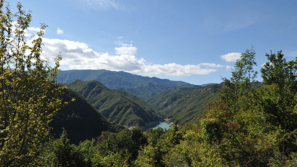
From S. Piero in Bagno you reach Via Verdi, which from Piazza Allende reaches the nineteenth-century stone bridge on the Fosso di Paganico. Go over it and take the mule track on the left that goes up to the municipal road, for long stretches of asphalt, which leads to the fraction of Paganico and Rio Salso. In short you reach the inhabited farms of Raggio di Sotto and Raggio di Sopra, where the mule track is crossed by the road that goes up from S. Piero. We follow the municipal on the left and - ignoring then the detour that on the left leads to Paganico - we follow it, passing in front of the inhabited farm Vetrice and the house of Fontabate, near Montepiano. Once you reach a clearing, take a long dirt road on the left, closed by a bar: keeping the ridge and ignoring the deviations on the left, it leads to Monte Castelluccio, bypasses Monte Carpano and shortly after, you enter the "Mulattiera di Pietrapazza" which leads from Bagno to the "small" Bidente valley. After a few tens of meters on the right, the mule track emerges on the Passo di Monte Carpano, crossing the forest track that comes from the Mandrioli road (on the left) and goes down to Pietrapazza. We follow this dirt road on the right to come out to the side of the abandoned church of S. Eufemia in Pietrapazza. Carefully passed a bar, we continue to descend along the track that runs on the right bank of the Bidente. Then, where the valley opens and widens, it is at Pian del Ponte: here, a stone bridge crosses the Bidente on the left and goes to Strabatenza. We instead continue the course of the Bidente until the indication for Ca 'di Veroli, on the right, which we reach shortly. Then we take the mule track that goes to Rio Salso: it starts right next to Ca 'di Veroli and goes up the namesake ditch which then climbs over a stone bridge (Riacci) to reach the core of Rio Salso with a series of hairpin bends. on a hill. In the place, abandoned for years, now rises the hotel "Rio Salso", open occasionally, next to which begins a long dirt road that goes up to Monte Piano. However, we advise you to take the old mule track that passes by the falling church and climbs steeply up to the ridge and then quietly reach the square, from where you go down to S. Piero, along the road made in the morning.
ROUTE: S. Piero in Bagno (463 asl) - Monte Piano (1049) - Monte Castelluccio (1115) - Monte Carpano (1131) - Pietrapazza (801) - Ca 'di Veroli (654) - Rio Salso (712) - Monte Floor (1049) - S. Piero in Bagno. LENGTH: 25 km. Gates and bars: Rio Salso and Monte Piano, Pietrapazza. The route is entirely marked. Not recommended in summer. Parking in S. Piero in Bagno.


 Facebook
 Instagram
 Youtube